February 11
Area:
LCC, BCC and Millcreek.
Location:
Flagstaff to Upper Days to Main Days to Mill D North to Soldier, out Millcreek.
Elevations, slope angles and aspects:
6200’-10’400’, slope angles to 35°+, all aspects.
Avalanche activity:
Surface sluffing within new snow in Upper Days from cornice kicking.
natural in upper Days.

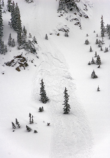
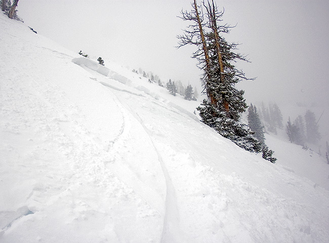
More of the same in Main Days. Ski cut produced a slide in main Days which was collapse failure on an eggshell mf crust over faceted snow

. The slide took the crust as it ran. It was 40-50’ wide, running a coupla hundred vertical, up to about 14” deep. Widespread cracking and collapsing on east facing Upper Days, while on the ascent. Resulted from the eggshell crust facet sandwich described above.
Slopes skied:
Upper Days, Main Days, Soldier Fork.
Snow surface and conditions:
4-7” new snow overnight and an additional few inches during the day. Bonding of the new snow, with the old surface was for the most part good. There were some shallow new snow sluffs in Upper Days noted on gaining the ridge. One natural soft slab mid slope below Jaws, new snow old snow interface, triggered by a cornice fall. Other activity noted above.
Crusts of variable thick nesses make up the old snow surface. I’m including old ski tracks as crusts. The most sensitive areas found today were on east facing upper elevations, a crust facet sandwich, sometimes several crusts in between. Collapsing was common in these areas. A few feet in one direction or another either eliminated the crust or it was stout and supportable. Similar condition in upper Soldier Fork, north facing without the load of Days.
Lower elevations had 1-3” crunchy dense snow. Got soaked by rain below about 7500’ on the Millcreek road exit.
Weather:
Overcast with snow flurries for most of the day. Winds would increase and decrease from a westerly direction, gusting into the 30+ mph range at times. Moderate temperatures.
Evaluation:
Snow amounts in areas traveled did not warrant an avalanche warning. Winds were the major player. An increase in wind over a short period overloaded ne facing in Main Days to the point of avalanche with a ski cut. I’d expect with the rising snow line experienced late in the afternoon and continued winds over 15 mph would increase the hazard somewhat. The areas with the weakest snow and receiving the most wind effect would be the primary candidates for avalanche. Rain at lower elevations could saturate north facing but, the rain is also melting much of the lingering snow. I’d expect natural activity in localized areas including both sluffs and soft slabs. Continued significant snow and wind could produce widespread activity, mainly at the upper elevations, especially those with an easterly facing aspect.
© wowasatch.com